What a Transit Map Is Actually Showing You
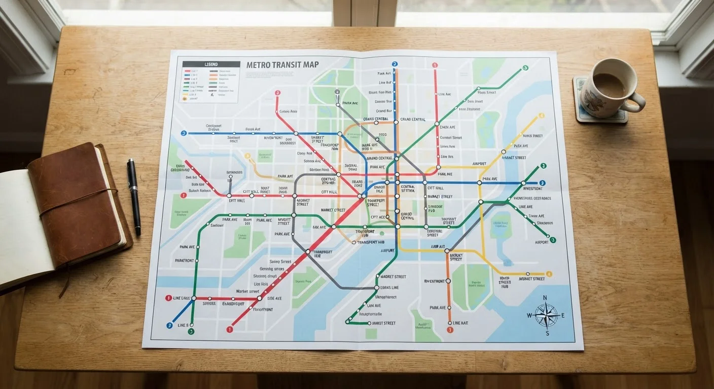
A transit map is a schematic diagram, not a street map. Its job is to show you how routes connect, not to reflect real-world geography. That's why a line that runs diagonally across a city might appear perfectly straight, or why two stations that look close together on the map might actually be a kilometer apart in real life.
Every transit map shares a handful of common elements:
- Lines — each distinct color or pattern represents one route (a subway line, metro line, or bus rapid transit corridor).
- Stations — marked as dots or circles along each line, labeled with the station name.
- Terminal stations — the stations at each end of a line, shown in bold or with a different symbol. These name the direction of travel.
- Interchange stations — where two or more lines cross and passengers can transfer between them.
Schematic diagram
A simplified drawing that shows how parts of a system connect, without trying to reflect real geography or distance accurately.
Terminal station
The last stop at either end of a transit line. Its name is used on signs and displays to indicate which direction a train is traveling.
Interchange station
A station where two or more transit lines meet, allowing riders to switch between routes without leaving the system.
Fare zone
A geographic area within a transit network used to calculate ticket prices. Traveling through more zones typically costs more.
Transfer
Switching from one transit line to another during a single journey, usually at an interchange station.
Express vs. local service
Some lines run express (skipping certain stations for faster travel) while others are local (stopping at every station). Maps often distinguish these with different line styles.
Once you recognize these four elements, any transit map — from Tokyo to Toronto — becomes a puzzle you already know how to solve.
Lines, Stations, and Interchanges Explained
Color is the primary organizing principle of most transit maps. Each line gets a unique color (and sometimes a letter or number too, for accessibility). When you see a solid red line, every station along that line is served by the same route.
Interchange stations appear where two or more lines overlap. They're usually indicated by a larger dot, a circle with a white fill, or a special icon. At an interchange, you can exit one train, walk to a different platform, and board a different line — often without paying again, though this varies by city.
Pick Your Direction Before You Board
Before stepping onto a platform, confirm the terminal station name for your intended direction and look for it on platform signs or electronic displays. If you're unsure, it takes only a moment to ask a fellow passenger or station staff — most are used to the question.
Terminal stations matter because they tell you which direction a train is traveling. If you need to go north on the Blue Line, and the northern terminal is called Central Station, boards and displays will read toward Central Station. Knowing this prevents one of the most common beginner errors: boarding in the wrong direction. For a deeper look at other easy-to-make mistakes, see common first-time transit rider errors.
Understanding Zones and Fare Areas
Many transit networks layer a zone system on top of the route map. Zones are concentric rings spreading outward from the city center, and crossing from one zone into the next typically increases your fare. A short trip entirely within Zone 1 costs less than a journey that passes through Zones 1, 2, and 3.
On the map, zones are often shown as lightly shaded bands or color-coded backgrounds behind the station names. Not every network uses zones — some cities charge a flat fare for any journey — but when they're present, they're worth understanding before you buy a ticket.
Zone Systems Vary Widely by City
Some cities use two zones, others use six or more, and a few have no zones at all. Always consult the specific transit authority's fare chart — available at ticket machines or on the official website — before assuming how much a journey will cost. Prices and zone boundaries are set by each transit authority and can change.
For a thorough breakdown of how zone structures work across different city networks, this explainer on fare zones covers the mechanics in plain language.
How to Plan a Route Step by Step
Reading a map is one skill; planning a route is another. Here's a repeatable process that works on any transit network:
- Find your starting station. Locate the station closest to where you are now. If you're unsure, check a street map alongside the transit map.
- Find your destination station. Identify which station is nearest to your destination.
- Trace the lines. See if a single line connects both stations directly. If it does, note the terminal station in your direction — that's your travel direction.
- Identify necessary transfers. If no single line connects your start and end, find an interchange station where you can switch. Note which line you'll take first and which line you'll transfer to.
- Count the stops. This gives you a rough sense of travel time and helps you stay alert as you approach your destination.
For a complete walkthrough of every stage from hotel to destination, see our end-to-end guide to using transit in an unfamiliar city.
Common Confusion Points and How to Resolve Them
Even after studying the map, a few situations reliably trip up first-time riders:
- The map shows one station but arrivals show a different name
- Some stations have been renamed or have official names alongside informal nicknames. Cross-check with the transit authority's official map if signage doesn't match.
- Two lines run parallel but aren't interchangeable
- Parallel lines on a map can serve different purposes — one may be express (stopping at fewer stations), one local. Look for small indicators like dashes, hollow circles, or different line weights.
- The station you need isn't on the map at all
- Your destination might be served by a bus or surface tram on a separate route map. Ask at any staffed station or look for supplemental route diagrams posted on walls.
Transit maps follow the same visual logic as other schematic diagrams — just as a cruise ship deck plan uses a simplified layout to show cabin placement and amenities, a transit map strips away geography to reveal the network's structure. If you've ever puzzled over a cruise ship deck plan, the mental process is very similar.
Transit apps are a practical supplement, especially for real-time departures. Understanding what transit apps can and can't do before you arrive helps you use them as a complement to the map rather than a replacement for it.